- Context (PIB): The Union Minister of Communications launched the Sanchar Saathi Mobile App.
- It is a user-friendly platform designed to fortify telecom security and empower citizens.
- It is available for both Android and iOS platforms.
Key features
- Chakshu: Users can report Suspected Fraud Communications (SFCs), including calls and SMS, using the app or directly from mobile phone logs.
- Know Mobile Connections in Your Name: Citizens can identify and manage all mobile connections issued in their name, ensuring no unauthorised usage.
- Blocking Your Lost/ Stolen Mobile Handset: Lost or stolen mobile devices can be swiftly blocked, traced and recovered.
- Know Mobile Handset Genuineness: The app offers an easy way to verify the authenticity of mobile handsets, ensuring users purchase genuine devices.
{GS2 – MoPR – Initiatives} SVAMITVA Scheme
- Context (IE): The SVAMITVA scheme aims to provide property cards to rural households, unlocking economic activity worth over Rs 100 lakh crore.
- SVAMITVA is a Central Sector Scheme of the Ministry of Panchayati Raj.
Key Features
- SVAMITVA stands for Survey of Villages and Mapping with Improvised Technology in Village Areas.
- Aims to complete surveying of all 6.62 lakh villages in phases, with a projected end date 2025.
- Provides legal property rights to rural households through drones & satellite imagery to survey properties in rural areas, creating GIS-based maps.
- After ground verification, final property cards or title deeds are issued digitally or in hard copy.
- Multi-Stage Process: Involves MoU between Survey of India (SoI) & state govts, followed by establishing a Continuously Operating Reference System (CORS) for accurate surveying.
- Surveying: Involves demarcating village boundaries, drone-based mapping, and ground truthing to correct discrepancies.
- Enables property owners to use their land as collateral for loans & other financial benefits.
Benefits of SVAMITVA Scheme
- Financial Empowerment: Property owners can use their homes as financial assets, helping secure loans and start small businesses.
- Property Taxation: Facilitates tax collection at the Panchayat level, contributing to rural development.
- Clear Land Records: Eliminates land disputes, aids in land management, and supports rural planning.
- Market Liquidity: Increases the marketability of rural land, improving economic activity.
- Empowerment: Reduces social conflict over property ownership and empowers rural households with legal documentation.
- Improved Infrastructure: Funds from property taxes can be utilised for better rural infra. and services.
Challenges
- Awareness and Adoption: Awareness campaigns are essential to ensure widespread adoption of the scheme among rural residents.
- Implementation Delays: There may be challenges in timely survey completion across all villages, especially in remote areas.
- Disputes Resolution: Handling property disputes and ensuring accurate mapping during the ground verification process is crucial.
- Technological Gaps: Ensuring technological infrastructure and training for effective drone mapping in villages with limited resource access.
- Data Privacy: Addressing concerns related to data security and the privacy of surveyed property records.
Way Forward
- Global Recognition: The government plans to showcase SVAMITVA as a model at international forums like the World Bank Land Governance Conference in May 2025.
- Expansion: The scheme should focus on the saturation of surveys in all states and the final distribution of property cards by the end of FY 2023-24.
- Integration with Financial Systems: Further integration with banking and credit systems will ensure seamless access to loans for rural residents.
- Collaboration: Continued collaboration with state governments, panchayats, and technology providers will ensure successful scaling up of the scheme.
{GS2 – Polity – Bodies – Statutory} 1st Foundation Day of Lokpal
- Context (PIB): India celebrated the 1st Foundation Day of the Lokpal, marking 11 years since its establishment under the Lokpal and Lokayuktas Act, 2013.
- Lokpal and Lokayukta perform the function and role of an “Ombudsman”.
Historical Background
- The concept of ombudsman originated in 1809 in Sweden.
- In India, the former law minister Ashok Kumar Sen became the first Indian to propose the concept of a constitutional Ombudsman in Parliament in the early 1960s.
- Further, Dr. L. M. Singhvi coined the terms Lokpal and Lokayukta in 1963. Later, in 1966, the First Administrative Reforms Commission (1966) passed recommendations regarding the establishment of two independent authorities at the central and state levels.
- Lokpal and Lokayuktas Act, 2013: This act established statutory bodies to combat corruption in public offices. Lokpal was constituted on January 16, 2014, as a two-tier system, with Lokpal at the Union level and Lokayuktas at the State level.
- The first Chairperson was appointed in 2019, Justice Pinaki Chandra Ghosh.

Other Anti-Corruption Legislations
- Prevention of Corruption Act, 1988 (Amended in 2018): Criminalizes bribery and corruption with stricter penalties.
- Whistleblowers Protection Act, 2014: Ensures protection for whistleblowers from threats.
- Right to Information Act, 2005: Promotes transparency in government operations.
- Prevention of Money Laundering Act 2002: Strengthens global cooperation against money laundering.
- Companies Act, 2013: Regulates corporate fraud and governance.
- Benami Transactions (BT) Act, 1988 (Amended 2016): Criminalizes BT to conceal ownership.
- Black Money Act, 2015: Targets undisclosed foreign income and assets with heavy penalties.
- Fugitive Economic Offenders Act, 2018: Confiscates assets of offenders fleeing abroad.
Lokpal and Lokayuktas Act, 2013
Structure of Lokpal
- The Chairperson is a former CJI or Supreme Court Judge, with up to 8 members, equally divided between judicial and underrepresented groups (SC/ST/OBC, minorities, and women).
- Appointment: Made by the President based on recommendations from a Selection Committee.
Composition of the Lokpal Selection Committee
Mandate, Powers and Functions
- Legal Authority: Investigates corruption allegations against public officials under the Prevention of Corruption Act, 1988.
- Anti-Corruption Oversight: Ensures expeditious inquiry and prosecution of corruption cases while promoting accountability in governance.
- Accountability Mechanism: Refers complaints against central government servants to the Central Vigilance Commission (CVC) and oversees the accountability of public servants.
- Autonomy and Independence: Lokpal functions autonomously, with its inquiry and prosecution wings for investigation and trial.
- Investigation and Supervisory Role: Supervises the CBI, authorises search and seizure operations, and prevents the destruction of records during inquiries, thus ensuring fair and unbiased investigations.
- Civil Court Powers: The Inquiry Wing of the Lokpal is vested with civil powers of the Court for summoning, requisitioning documents, and examining witnesses.
- Asset Confiscation: Confiscates assets and proceeds gained through corruption in special cases.
- Administrative Actions: Recommends transfer, suspension, or other actions against public servants linked to corruption allegations.
- Reporting: Submits an annual report to the President, tabled in both Houses of Parliament.
Jurisdiction
- Coverage of Officials: Includes the PM (with specific exceptions), Union Ministers, Members of Parliament, and Groups A, B, C, and D officials.
- Exceptions for PM: Lokpal cannot probe allegations against the Prime Minister about international relations, security, atomic energy & space unless a full bench agrees with a 2/3rd majority.
- Institutional Scope: Covers chairpersons, members, officers & directors of boards, corporations, societies, trusts/autonomous bodies funded wholly/partially by the govt or established by an Act of Parliament.
- Foreign Contributions: Encompasses societies, trusts, or bodies receiving foreign contributions exceeding ₹10 lakh.
- Provisions for Whistleblowers: Provides safeguards for whistleblowers under the Whistle Blowers Protection Act, 2014.
- Complaint Mechanism: Accepts complaints from any individual in the prescribed form, provided they pertain to offences under the Prevention of Corruption Act, 1988.
Challenges Faced by Lokpal
- Delays in Appointments: First Lokpal appointed in March 2019, six years after the Act passed.
- Staffing Issues: Vacant positions such as Director of Inquiry and Director of Prosecution hinder efficient functioning.
- Investigation Setbacks: ~90% of complaints were rejected due to incorrect format/procedural errors.
- Coordination Problems: Reliance on other agencies (CBI, CVC) for investigations creates delays.
- Strengthening Infrastructure: Improved staffing, technological support, and budgetary allocations will speed up investigations.
- Enhanced Coordination: Collaborating more effectively with CBI & other agencies to reduce bottlenecks.
- Public Awareness: Educating citizens about Lokpal’s role can encourage more corruption reports.
- Transparency: Regular updates on investigations will increase trust in the institution.
{GS3 – Envi – Species} Pilot Whale Stranding in Sri Lanka
- Context (IE): 14 pilot whales stranded on the shores of Kalpitiya, Sri Lanka’s west coast, highlighting the phenomenon of Whale Strandings/ Whale Beaching.
Pilot Whales

Source: IWC
-
Species:
- Short-finned Pilot Whale (Globicephala macrorhynchus): Found in tropical and warm-temperate waters. IUCN Status: LC.
- Long-finned Pilot Whale (Globicephala melas): Found in colder waters, are further subdivided into three sub-species: the Southern long-finned pilot whale (G. m. edwardii), the North Atlantic long-finned pilot whale (G. m. melas), and the now extinct North Pacific long-finned pilot whale (G. m. un-named subsp.). IUCN status: CR.
- Social Structure: Highly social, often travelling in groups led by a dominant individual.
- Males of both species are larger than females. Both species are black; some individuals have a pale, elongated anchor-shaped mark adorning the throat and chest.
What is Whale Stranding?
- Whale stranding, or whale beaching, is a phenomenon where whales, dolphins, and porpoises swim into shallow waters and become trapped on land, often on beaches, often resulting in injury or death.
- Mass strandings sometimes can involve hundreds of marine animals at once.
Causes of Whale Stranding
- Topography: Shallow coastal areas can contribute to strandings, especially where deep waters rapidly transition to shallow regions.
- Illness or Injury: Sick or injured whales may end up stranded.
- Anthropogenic Activities: Commercial ships, military sonars, offshore drilling create disruptive noise pollution, which can disorient whales, affecting their ability to navigate, communicate, and find food.
- Predation: Threats from predators like killer whales or sharks may cause panic.
- Rising Sea Temperatures: Altered prey distribution may push whales closer to shore, increasing the risk of strandings.
- Seismic Activity like that in the Indian Ocean may disrupt whales’ navigation.
Locations Prone to Stranding
- Sri Lanka: Kalpitiya (2023), Panadura (2020), & other coastal regions have experienced whale strandings.
- Tasmania, Australia: Notable for mass strandings, such as the 2020 incident with 230 pilot whales.
- Golden Bay, New Zealand & Cape Cod, Massachusetts, USA: Hotspots with frequent strandings.
Also, refer to Killer Whales.
{GS3 – S&T – ISRO} Third Launch Pad
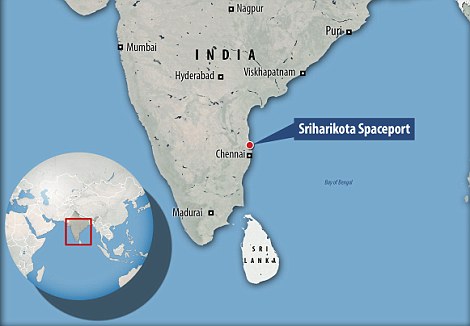
- Context (PIB): The Union Cabinet approved the establishment of the Third Launch Pad (TLP) at ISRO’s Satish Dhawan Space Centre in Sriharikota, Andhra Pradesh.

Source: People’s Daily
- It will also serve as a standby launch pad for the Second Launch Pad at Sriharikota, enhancing the launch capacity for future Indian human spaceflight missions.
- It can support the LVM3 vehicles with Semicryogenic stage and scaled up configurations of Next-Generation Launch Vehicles.
- Expected to be established within 4 years.
Satish Dhawan Space Centre
- The SDSC is the country’s only spaceport from which spacecraft and satellites are launched.
- It became operational in 1971, with the flight of ‘Rohini-125’, a small-sounding rocket, and was initially known as SHAR (Sriharikota Range). Currently, It has two launch pads.
- The First Launch Pad (FLP) was realised 30 years ago for PSLV and continues to support PSLV and SSLV.
- The Second Launch Pad (SLP) was established primarily for GSLV and LVM3 and functions as a PSLV standby. It has witnessed many successes, including the historical launch of the Chandrayaan-3 mission and the upcoming Gaganyaan mission.
Geographic advantage of being closer to the equator
- The surface velocity of rotation varies from point to point on the Earth. It is about 1600 km per hour or about 460 meters in a second near the equator. It gradually reduces as we move to the poles.
- A satellite launched from sites near the equator in the east direction will get an initial boost (approximately 460 m/s) equal to the velocity of the Earth’s surface.
- Why East? The Earth rotates from west to east (anti-clockwise).
- The initial boost helps reduce the cost of rockets used to launch satellites. This is the major reason for launching satellites in the eastward direction.
- Also, Sriharikota is sparsely populated, reducing the damage risk of falling rocket parts post-launch.
Exceptions
- The above benefit applies only to satellites placed in geostationary orbit or that circle the Earth parallel to the equator. Such satellites are usually communication satellites or satellites used for scientific research.
- Other satellites are placed in polar orbits, moving across the equator in a north-south direction.
- Such satellites are generally launched southward or northward and cannot take advantage of the Earth’s rotation. They are used mainly for mapping or spying.
- Escape velocity is the speed at which an object needs to be travelling to break free of a planet or moon’s gravity well and leave it without further propulsion. For example, a spacecraft leaving the surface of Earth needs to be going 7 miles per second, or nearly 25,000 miles per hour, to leave without falling back to the surface or falling into orbit.
|
Also, refer to Kulasekarapattinam Spaceport in Tamil Nadu.
{GS3 – S&T – Space} India’s first private satellite constellation
- Context (IE): Google-backed India’s space tech startup Pixxel achieved a milestone by launching three hyperspectral imaging satellites aboard a SpaceX rocket.
- The satellites aim to use hyperspectral imaging to capture highly detailed data across hundreds of light bands, serving industries such as agriculture, mining, environmental monitoring, and defence.
- The startup plans to add 18 more spacecraft to the six it has already developed.
- Pixxel’s hyperspectral imaging satellites are uniquely designed to beam down data in hundreds of wavelengths to detect invisible problems to today’s satellites.
- The constellation is designed to provide global coverage at a revisit of every 24 hours.
Hyperspectral Imaging (HSI)
- Hyperspectral imaging (HSI) is a technique that analyses a wide spectrum of light instead of just assigning primary colours (red, green, blue) to each pixel.
- The collected spectra form an image, with each pixel including a complete spectrum. Images are captured and analysed using 100s of wavelengths rather than 10s of wavelengths, as done currently.
")
Source: Pixxel
{GS3 – S&T – Space} ISRO’s SpaDeX Mission
- Context (IE): ISRO successfully completed the docking of two satellites as part of the SpaDeX mission, thus making India the fourth country to dock satellites, after the USA, Russia & China.
About Space Docking Experiment (SpaDeX)
- SpaDeX is a cost-effective technology demonstrator mission that will demonstrate in-space docking using two small spacecraft (‘Chaser’ and ‘Target’) designed to be launched from a single PSLV class vehicle and to dock at an altitude of about 700 kilometres.
- Objective: SpaDeX mission aims to demonstrate rendezvous, docking, and undocking technologies, focusing on key technologies like electrical power transfer between the docked spacecraft, in-space robotics, and conducting payload operations after undocking.
- First Experiment: SpaDeX is ISRO’s first satellite docking experiment.
- Launch Details: Launched on December 30, 2024, from Sriharikota by ISRO’s PSLV-C60, placing two 220-kg satellites in a 475-km circular orbit.
- Duration: The mission will run for 2 years.
- Docking Process: The spacecraft will reduce the distance from 20 km to 3 m.
- Biological Research: SPADEx will support biological studies on plant growth and bacteria, green propulsion systems and artificial intelligence labs in microgravity.
What is Orbital/Space Docking?
- Orbital docking is joining two space vehicles together in space. The docking process can be temporary or semi-permanent. For e.g., space station modules can dock with International Space Station (ISS).
- This process, whether manned or unmanned, allows those to operate as a single unit for critical tasks such as refuelling, repair, and crew exchange.
- The first docking was achieved in 1966 when Gemini 8, under the command of American astronaut Neil Armstrong, docked with Agena Target Vehicle (it was uncrewed).
|
Technologies Involved
- Sensor Suite: Laser Range Finder, Rendezvous Sensor, and Proximity & Docking Sensors were used for precise measurements during the docking process.
- SpaDeX A (Chaser) is equipped with a high-resolution camera for monitoring & imaging, SpaDeX B (Target) carries a multispectral payload, radiation monitor & other scientific tools.
- Robotic Experimentation: Robotic arms will be validated for satellite servicing.
- Docking Mechanism: Androgynous, using identical systems on both satellites.
- POEM (PS4 Orbital Experiment Module): The fourth stage of PSLV will be repurposed to test critical in-orbit technologies, including docking and power transfer.
- CROPS mission utilised the PSLV Orbital Experiment Module (POEM)-4 platform to cultivate cowpea seeds in a controlled environment with active thermal management.
About CROPS Mission
- CROPS Mission, developed by Vikram Sarabhai Space Centre (VSSC), is ISRO’s first biological experiment to grow plants in space under microgravity conditions.
- Design: The CROPS module functions like a mini greenhouse with Earth-like conditions in space.
- Growing Medium: Highly porous clay pellets aid water retention and nutrient release through slow-release fertilisers.
- Light Simulation: Eight LEDs (four warm, four cool) mimic day-night cycles, with lights programmed to be on for 16 hours and off for 8 hours.
- Temperature & Atmosphere Control: The module’s temperature is maintained between 20 to 30°C, with Earth-like atmospheric conditions.
- Water Delivery: Water is injected into the soil-like medium via an electric valve operated from Earth.
- Results: Lobia seeds sprouted on 4th day & leaves appeared on 5th, signaling successful germination.
Indigenous Technologies Involved
- Inter-Satellite Communication Link (ISL) for autonomous communication.
- GNSS-based Relative Orbit Determination Processor for determining spacecraft positions & velocities.
- Autonomous Rendezvous and Docking Strategy developed for precise operations.
Mission Significance
- Space Docking is crucial for future space missions such as:
- Chandrayaan-4 for Moon sample return.
- Bharatiya Antariksh Station planned for 2028.
- Satellite Servicing and Maintenance to extend operational lifespans of satellites.
- In-space Robotics and future satellite missions for resource monitoring.
- Paves Way for the Third Launch Pad at Sriharikota: Approved for the Next Generation Launch Vehicle (NGLV), supporting future space missions and enabling heavier satellite launches.
- Enhanced Indian Position: Only the US, Russia & China have successfully demonstrated space docking.
- Precision and Coordination: The SpaDeX mission demonstrates India’s ability to control spacecraft at high velocities, which is essential for future deep space missions.
- Self-Reliance: The mission showcases India’s growing space capabilities, moving closer to autonomous space operations.
- Need for Space Weather Monitoring: The mission underscores the importance of real-time space weather forecasts to ensure safe space operations, especially during solar maximum phases.
Impact of Solar Activity on SpaDeX
- Favorable Solar Conditions: The mission occurred during solar cycle 25 with reduced solar disturbances, avoiding interference from solar flares and coronal mass ejections (CMEs), and fewer sunspots, ensuring smooth docking operations.
- Space Weather Risks: Solar flares and CMEs can disrupt spacecraft operations, blinding sensors and causing communication breakdowns.
- Magnetic Storms: High-speed solar winds can lead to positional errors, complicating docking.
{GS3 – S&T – Space} Mission SCOT
- Context (DH): PM congratulated space startup Digantara for the success of Mission SCOT (Space Camera for Object Tracking).
- Core objective: Precisely track and image RSOs (Resident Space objects) in the Lower Earth Orbit.
- Launched by: SpaceX’s Falcon 9 (Transporter-12 mission)
- Orbit: Sun-synchronous orbit.
- Supported by: Aditya Birla Ventures and SIDBI.
- The first three satellites of the Firefly constellation by Bengaluru-based Pixxel and ELEVATION-1, a US-based Almagest Space Corporation satellite wholly designed and developed by Hyderabad-based XDLINX Spacelabs, were also onboard Transporter-12 rocket.
|
{Prelims – PIN India} Jio Launches 4G and 5G Services at Siachen Glacier
- Context (TH | ET): Jio rolled out 4G & 5G internet services at Siachen Glacier, the world’s highest battlefield, with support from the Indian Army, marking a technological milestone in extreme conditions.
About Siachen Glacier
- “Siachen” means place of roses in the local Balti language. The Siachen glacier is 76 km long, and its width varies between 2 km and 8 km, and it extends up to Gilgit-Baltistan.
- The glacier hangs at the snout towards OP Baba Shrine (a multifaith temple named after Om Prakash, an artillery soldier) and Indira Col (called by the Workman expedition after goddess Laxmi) at the northernmost point of the Saltoro Ridge.
- It is the Second-Longest glacier in the Non-Polar areas after the Fedchenko Glacier in Tajikistan.
- The Siachen Glacier lies immediately south of the great drainage divide that separates the Eurasian Plate from the Indian subcontinent in the extensively glaciated portion of the Karakoram, sometimes called the “Third Pole“. Nubra River originates from Siachen Glacier.
Location of Siachen Glacier

Source: Wikimedia
- Siachen sits on the nuclear tri-junction of India, Pakistan and China, the world’s only nuclear triangle.
- It forms part of the Union Territory of Ladakh.
- It is located in the eastern Karakoram range in the Himalayas Mountains, just northeast of the point NJ9842, where the Line of Control between India and Pakistan ends.
History of Siachen
- The Trouble began with the drawing up of a UN-brokered India-Pakistan ceasefire line in 1949 following the first war between India and Pakistan.
- The subsequent Karachi accord that year left boundary delineation incomplete.
- In 1984, India launched Operation Meghdoot to capture the 76.4 km-long glacier on the Saltoro ridge.
- However, following the 2003 ceasefire along the Line of Control (LoC) and the Actual Ground Position Line (AGPL) across the Siachen, there has been no shooting.
- While India and Pakistan delineated and accepted the LoC up to Pt. NJ9842, Siachen was left unmarked.
- India claims the area based on the Jammu and Kashmir Instrument of Accession (1947) and Karachi Accord of 1949, which define the ceasefire line beyond NJ9842 as “running Northwards to the glaciers”.
Why is Siachen important?
- The glacier complex includes the Saltoro Ridge that overlooks the Gilgit-Baltistan area of Pakistan-Occupied Kashmir (POK).
- The ridge with high peaks guards the routes leading to Leh, the capital of Ladakh. Towards the north, it overlooks and dominates the Shaksgam Valley, which was illegally ceded to China by Pakistan.
- It is close to the Karakoram Pass, which is where the Karakoram Highway passes, connecting Gilgit-Baltistan to Xinjiang province in China. Siachen is a wedge between Pakistan and China, keeping the two from linking up deeper towards the north of Kargil and Leh.
- The China factor in the region was never discounted as the China-Pakistan Economic Corridor (CPEC) is geographically close to the Siachen glacier. Growing military ties between China and Pakistan brought to India the genuine challenge of a possible ‘two-front war’.
- The ground dynamics shift is due to around 60,000 PLA forces in Eastern Ladakh up to Y Junction, which is close to the critical Daulat Beg Oldi (DBO) airfield.
- According to recent estimates and official figures, around Rs 6 crore is spent daily to keep a brigade—around 5,000 troops—in Siachen.
4G and 5G Deployment at Siachen Glacier
- First Telecom Operator: Reliance Jio is the first to deploy 4G and 5G services in Siachen Glacier.
- Collaboration with Army: The Indian Army supported the operation through logistics management, including airlifting equipment.
- Location Details: Services are available at a forward post in the Karakoram Range at 16,000 feet in extreme weather conditions with temperatures reaching – 50°C.
Impact on Communication and Operations
- Enhanced Soldier Connectivity: Soldiers stationed at the glacier now have access to high-speed internet, improving communication and operational efficiency.
- Strategic Importance: The deployment strengthens connectivity in one of the world’s most remote and inhospitable areas, enabling real-time communication and operational coordination.
{Prelims – PIN World – Asia} Gulf of Aden
- Context (TH): The defence minister indicated a possibility of an increase in threats in the Gulf of Aden while addressing an event organised to commemorate 2024 as the ‘Year of Naval Civilians’.
- Naval civilians constitute a third of the Navy’s workforce, often called “Soldiers without Uniforms.”
|
- The Gulf of Aden is in the Indian Ocean, between Yemen on the south coast of the Arabian Peninsula and Somalia in Africa.

- The Gulf runs in a west-east direction — roughly 900 kilometres long and 500 kilometres wide. It is an important waterway for transporting Persian Gulf oil.
- Together with the Red Sea, which connects within the northwest through the Bab el Mandeb, it forms an essential oil transport route between Europe and the Far East.
- When the British military withdrew from the area in the late 1960s, the use of the gulf was diminished due to the closing of the Suez Canal. Egypt renovated and reopened the canal in 1975.
- In recent years, the Gulf has received a lot of attention due to piracy, terrorism, and refugee smuggling.
- According to the United Nations High Commissioner for Refugees (UNHCR), 142 people died in 2023 while crossing the Gulf of Aden from the Horn of Africa to Yemen coast in search of refugee status.


")


