
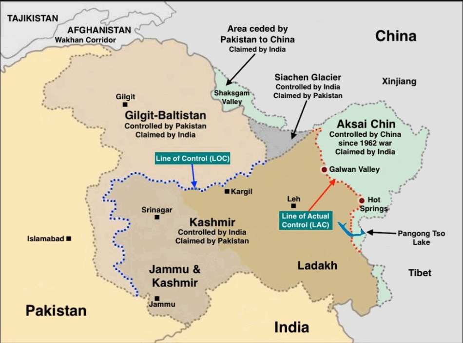
Pangong Lake (Pangong Tso) and The Surrounding Disputed Regions


Pangong Lake
- Context (TH): There is a significant focus on infrastructure development, including road networks and advanced landing grounds in the region surrounding Pangong Lake, by both India and China.
Recent Developments in the Galwan Clash Area
Indian Infrastructure Initiatives
- India is constructing a black-topped road towards Finger 4 on the north bank, expected to be completed by 2025.
Budgetary Allocation and Progress
- The Border Roads Organization (BRO) budgetary allocation has increased significantly.
- The BRO’s capital budget for 2023-24 was ₹5,000 crore, a 43% increase from the previous year.
- The India-China Border Roads (ICBR) plan has made significant progress in constructing over 1,400 km of strategic roads along the Line of Actual Control (LAC).
Chinese Infrastructure Initiatives
- Construction work is underway on the main bridge on the Chinese side, while the second bridge has already been completed.
- Large-scale construction activity has been observed on the north bank, including road connectivity towards Shandong village.
- A Chinese air defence site is located east of the Khurnak Fort.
Ongoing Disputes and Talks
- Despite the infrastructure developments, the Corps Commander-level talks between India and China remain deadlocked.
- Friction points at Depsang and Demchok continue to be contentious, with the Chinese side blocking Indian patrols.

Pangong Tso
- In the Ladakhi language, Pangong means extensive concavity, and Tso is lake in Tibetan.
- Pangong Tso is a long narrow, deep, endorheic (landlocked) saline (brackish) lake situated at a height of more than 14,000 ft (4,270 m) in the Ladakh Himalayas.
- The 135 km-long lake is shaped like a boomerang and is 6 km wide at its broadest point.
- The Karakoram Mountain range (Tajikistan, Afghanistan, Pakistan, China & India) ends at the north bank of Pangong Tso.
- 1/3rd of the lake is under Indian control while the rest is under Chinese control.


Tactical significance of the Lake
- By itself, the lake does not have major tactical significance. But it lies in the path of the Chushul approach, one of the main approaches that China can use for an offensive into Indian-held territory.

- The Chushul Valley has a vital airstrip that played an important role during the 1962 War with China.
- Chushul is the gateway to Leh. If China enters Chushul, it can launch its operations against Leh.
- Chushul is one of the five Border Personnel Meeting points between the Indian and Chinese armies.


