
Hills of Peninsular India: Aravalis, Vindhyas, Satpuras, Western & Eastern Ghats
Subscribe to Never Miss an Important Update! Assured Discounts on New Products!
Must Join PMF IAS Telegram Channel & PMF IAS History Telegram Channel
Last updated on April 25, 2024 1:10 PM
Hill Ranges of the Peninsular Plateau
- Most of the hills in the peninsular region are of the relict type (residual hills).
- They are the remnants of the hills and horsts formed many million years ago (horst: uplifted block; graben: subsided block).
- The plateaus of the Peninsular region are separated from one another by these hill ranges and various river valleys.

Aravali Range
- They are aligned in north-east to south-west direction.
- They run for about 800 km between Delhi and Palanpur in Gujarat.
- They are one of the oldest (very old) fold mountains of the world and the oldest in India. {Fold Mountains – Block Mountains}
- After its formation in Archaean Era (several 100 million years ago), its summits were nourishing glaciers and several summits were probably higher than the present day Himalayas.
- Now they are relict (remnants after severe weathering and erosion since millions of years) of the world’s oldest mountain formed as a result of folding (Archaean Era).
- They continue up to Hariddwar buried under the alluvium of Ganga Plains.
- The range is conspicuous in Rajasthan (continuous range south of Ajmer where it rises to 900 m.) but becomes less distinct in Haryana and Delhi (characterized by a chain of detached and discontinuous ridges beyond Ajmer).
- According to some geographers, one Branch of the Aravalis extends to the Lakshadweep Archipelago through the Gulf of Khambhat and the other into Andhra Pradesh and Karnataka.
- It’s general elevation is only 400-600 m, with few hills well above 1,000 m.
- At the south-west extremity the range rises to over 1,000 m. Here Mt. Abu (1,158 m), a small hilly block, is separated from the main range by the valley of the Banas. Guru Sikhar (1,722 m), the highest peak, is situated in Mt. Abu.
- Pipli Ghat, Dewair and Desuri passes allow movement by roads and railways.
Vindhyan Range
- The Vindhyan Range, overlooking (have a view of from above) the Narmada valley, rises as an escarpment (a long, steep slope at the edge of a plateau or separating areas of land at different heights) flanking (neighboring on one side) the northern edge of the Narmada-Son Trough (the rift through which the Narmada river flows)(trough is opposite of ridge. It is a narrow depression).
- It runs more or less parallel to the Narmada Valley in an east-west direction from Jobat in Gujarat to Sasaram in Bihar for a distance of over 1,200 km.
- The general elevation of the Vindhyan Range is 300 to 650 m.
- Most parts of the Vindhayan Range are composed of horizontally bedded sedimentary rocks of ancient age. {Rock System}
- The Vindhyas are continued eastwards as the Bharner and Kaimur hills.
- This range acts as a watershed between the Ganga system and the river systems of south India.
- The rivers Chambal, Betwa and Ken rise within 30 km of the Narmada.
Satpura Range
- Satpura range is a series of seven mountains (‘Sat’ = seven and ‘pura’ = mountains)
- It runs in an east-west direction south of the Vindhyas and in between the Narmada and the Tapi, roughly parallel to these rivers.
- It stretches for a distance of about 900 km.
- Parts of the Satpuras have been folded and upheaved. They are regarded as structural uplift or ‘horst’.
- Dhupgarh (1,350 m) near Pachmarhi on Mahadev Hills is the highest peak.
- Amarkantak (1,127 m) is another important peak.
Western Ghats (or The Sahyadris)
- They form the western edge of the Deccan tableland.
- Run from the Tapi valley (21° N latitude) to a little north of Kanniyakumari (11° N latitude) for a distance of 1,600 km.
- The Western Ghats are steep-sided, terraced, flat-topped hills presenting a stepped topography facing the Arabian Sea coast.
- This is due to the horizontally bedded lavas, which on weathering, have given a characteristic ‘landing stair aspect’ to the relief of this mountain chain.
- The Western Ghats abruptly rise as a sheer wall to an average elevation of 1,000 m from the Western Coastal Plain.
- But they slope gently on their eastern flank and hardly appear to be a mountain when viewed from the Deccan tableland.
- South of Malabar, the Nilgiris, Anamalai, etc. present quite different landscape due to the difference in geological structure.
The northern section
- The northern section of the Ghats from Tapi valley to a little north of Goa is made of horizontal sheets of Deccan lavas (Deccan Traps).
- The average height of this section of the Ghats is 1,200 m above mean sea level, but some peaks attain more heights.
- Kalasubai (1,646 m) near Igatpuri, Salher (1,567 m) about 90 km north of Nashik, Mahabaleshwar (1,438 m) and Harishchandragarh (1,424 m) are important peaks.
- Thal ghat and Bhor ghat are important passes which provide passage by road and rail between the Konkan Plains in the west and the Deccan Plateau in the east.
[Konkan coast == Maharashtra coast and Goa coast;
Malabar Coast == Kerala and Karnataka coast]
The Middle Sahyadri
- The Middle Sahyadri runs from 16°N latitude upto Nilgiri hills.
- This part is made of granites and gneisses.
- This area is covered with dense forests.
- The western scarp is considerably dissected by headward erosion of the west flowing streams.
- The average height is 1200 m but many peaks exceed 1500 m.
- The Vavul Mala (2,339 m), the Kudremukh (1,892 m) and Pashpagiri (1,714 m) are important peaks.
- The Nilgiri Hills which join the Sahyadris near the trijunction of Karnataka, Kerala and TN, rise abruptly to over 2,000 m.
- They mark the junction of the Western Ghats with Eastern Ghats.
- Doda Betta (2,637 m) and Makurti (2,554 m) are important peaks of this area.
The southern section
- The southern part of the Western Ghats is separated from the main Sahyadri range by Pal ghat Gap [Palakkad Gap].
- The high ranges terminate abruptly on either side of this gap.
- Pal ghat Gap it is a rift valley. This gap is used by a number of roads and railway lines to connect the plains of Tamil Nadu with the coastal plain of Kerala.
- It is through this gap that moist-bearing clouds of the south-west monsoon can penetrate some distance inland, bringing rain to Mysore region.
- South of the Pal ghat Gap there is an intricate system of steep and rugged slopes on both the eastern and western sides of the Ghats.
- Anai Mudi (2,695 m) is the highest peak in the whole of southern India.
- Three ranges radiate in different directions from Anai Mudi. These ranges are the Anaimalai (1800-2000 m) to the north, the Palani (900-1,200 m) to the north-east and the Cardamom Hills or the Ealaimalai to the south.
Eastern Ghats
- Eastern Ghats run almost parallel to the east coast of India leaving broad plains between their base and the coast.
- It is a chain of highly broken and detached hills starting from the Mahanadi in Odisha to the Vagai in Tamil Nadu. They almost disappear between the Godavari and the Krishna.
- They neither have structural unity nor physiographic continuity. Therefore these hill groups are generally treated as independent units.
- It is only in the northern part, between the Mahanadi and the Godavari that the Eastern Ghats exhibit true mountain character. This part comprises the Maliya and the Madugula Konda ranges.
- The peaks and ridges of the Maliya range have a general elevation of 900-1,200 m and Mahendra Giri (1,501 m) is the tallest peak here.
- The Madugula Konda range has higher elevations ranging from 1,100 m and 1,400 m with several peaks exceeding 1,600 m. Jindhagada Peak (1690 m) in Araku Valley Arma Konda (1,680 m), Gali Konda (1,643 m) and Sinkram Gutta (1,620 m) are important peaks.
- Between the Godavari and the Krishna rivers, the Eastern Ghats lose their hilly character and are occupied by Gondwana formations (KG Basin is here).
- The Eastern Ghats reappear as more or less a continuous hill range in Cuddapah and Kurnool districts of Andhra Pradesh where they are called as Nallamalai Range [Naxalite hideout in AP] with general elevation of 600-850 m.
- The southern part of this range is called the Palkodna range.
- To the south, the hills and plateaus attain very low altitudes; only Javadi Hills and the Shevroy-Kalrayan Hills form two distinct features of 1,000 m elevation.
- The Biligiri Rangan Hills in Karnataka (at its border with Tamil Nadu) attain a height of 1,279 m.
- Further south, the Eastern Ghats merge with the Western Ghats.
Significance of the Peninsular Plateau
- There are huge deposits of iron, manganese. copper, bauxite, chromium, mica, gold, etc.
- 98 per cent of the Gondwana coal deposits of India are found in the Peninsular Plateau.
- Besides there are large reserves of slate, shale, sandstones, marbles, etc.
- A large part of north-west plateau is covered with fertile black lava soil which is extremely useful for growing cotton.
- Some hilly regions in south India are suitable for the cultivation of plantation crops like tea, coffee, rubber, etc..
- Some low lying areas of the plateau are suitable for growing rice.
- The highlands of the plateau are covered with different types of forests which provide a large variety of forest products.
- The rivers originating in the Western Ghats offer great opportunity for developing hydroelectricity and providing irrigation facilities to the agricultural crops.
- The plateau is also known for its hill resorts such as Udagamangalam (Ooty), Panchmarhi, Kodaikanal, Mahabaleshwar, Khandala, Matheron, Mount Abu, etc.
Primary References: NCERT Geography, Indian Geography by Kullar [Amazon and Flipkart]
Last updated on April 25, 2024 1:10 PM








sir can you please explain Vindyan scarpland(VS)?
And whats difference between VS and Vindhyan range?
what is the lateral meaning of satpura ? can you give a reference
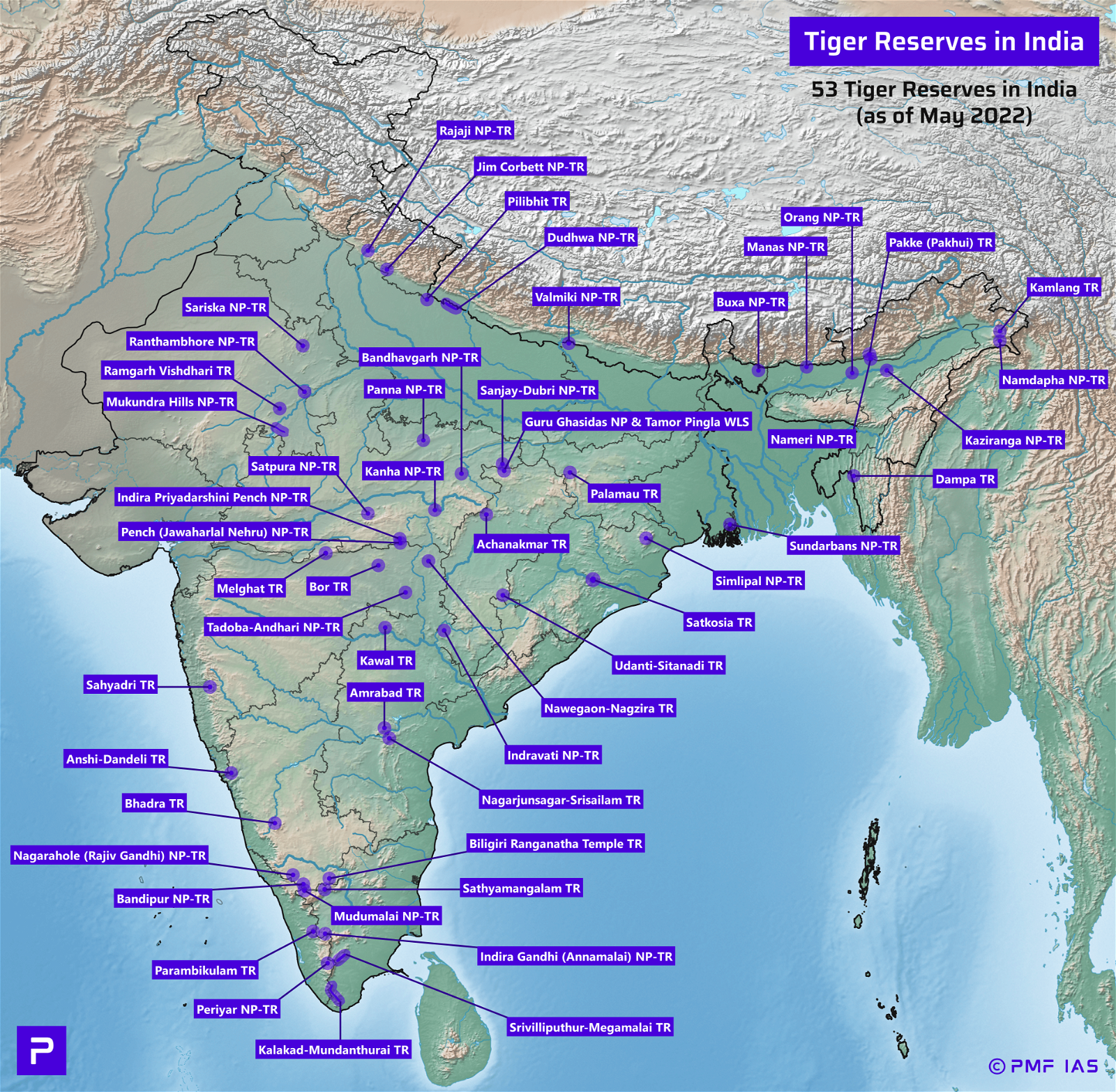
Sorry, I will correct the map in the next revision (by Feb 2019).
Highest peak in Eastern Ghats? Mahendra giri or Jindhagada. You have mentioned Mahendra giri which is only 1501 mts that is less than Jindhagada which is 1690 mts?