
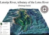
Classification of Drainage Systems of India
Contribution of Water by Various Rivers
River |
% Contribution of water |
| Brahmaputra | ~ 40 |
| Ganga | ~ 25 |
| Godavari | ~ 6.4 |
| Mahanadi | ~ 3.5 |
| Krishna | ~ 3.4 |
| Narmada | ~ 2.9 |
| Rest | ~ 20 |
Classification of Drainage Systems of India
Drainage Systems Based on the Size of the Catchment Area
Division |
Size of catchment area in sq km |
| Major river | 20,000 |
| Medium river | 20,000 – 2,000 |
| Minor river | 2,000 and below |
Drainage Systems Based on Origin
- The Himalayan Rivers: Perennial rivers: Indus, the Ganga, the Brahmaputra and their tributaries.
- The Peninsular Rivers: Non-Perennial rivers: Mahanadi, the Godavari, the Krishna, the Cauvery, the Narmada and the Tapi and their tributaries.
Drainage Systems Based on the Type of Drainage
The river systems of India can be classified into four groups viz.
- Himalayan rivers, Deccan rivers and Coastal rivers that drain into the sea.
- Rivers of the inland drainage basin (endorheic basin). Streams like the Sambhar in western Rajasthan are mainly seasonal in character, draining into the inland basins and salt lakes. In the Rann of Kutch, the only river that flows through the salt desert is the Luni.
Drainage Systems Based on Orientation to the sea
- The Bay of Bengal drainage (Rivers that drain into Bay of Bengal)(East flowing rivers)
- Arabian sea drainage (Rivers that drain into Arabian sea)(West flowing rivers).
- The rivers Narmada (India’s holiest river) and Tapti flow almost parallel to each other but empty themselves in opposite directions (West flowing). The two rivers make the valley rich in alluvial soil and teak forests cover much of the land.
The Bay of Bengal drainage |
Arabian Sea drainage |
| Rivers that drain into Bay of Bengal | Rivers that drain into Arabian sea |
| East flowing rivers | West flowing rivers |
| ~ 77 per cent of the drainage area of the country is oriented towards the Bay of Bengal | ~ 23 per cent of the drainage area of the country is oriented towards the Arabian sea |
| The Ganga, the Brahmaputra, the Mahanadi, the Godavari, the Krishna, the Cauvery, the Penneru, the Penneiyar, the Vaigai, etc. | The Indus, the Narmada, the Tapi, the Sabarmati, the Mahi and the large number of swift flowing western coast rivers descending from the Sahyadris. |
- The area covered by The Bay of Bengal drainage and Arabian Sea drainage are not proportional to the amount of water that drains trough them.
Over 90 per cent of the water drains into the Bay of Bengal; the rest is drained into the Arabian Sea or forms inland drainage.
Lop sided distribution
- The Arabian Sea drainage or Western drainage receive less rainfall [Rajasthan, Haryana and Punjab receive very low rainfall].
- The Eastern drainage or the Bay of Bengal drainage receives rainfall both from South-west and North-east monsoons.
- Most of the Himalayan waters (perennial rivers) flow into eastern drainage (Ganges and Brahmaputra).
- Indian Rivers that flow into Arabian Sea are seasonal or non-perennial (Luni, Narmada, etc.).
- Occurrence of more cyclonic rainfall in the eastern parts is another major reason.
Major River System or Drainage Systems in India
Himalayan River systems
- Indus River System
- Brahmaputra River System
- Ganga River System
Peninsular River Systems
- Godavari River System
- Krishna River System
- Cauvery River System
- Mahanadi River System
West Flowing Peninsular River Systems
- Narmada River System
- Tapti River System

- The names of the basins along with their id and area are given in the table.
| Sl. No | Basin Code | Basin Name | Area (sq.km) | Rank |
| 1 | 1 | Indus (Up to border) | 3,21,289 | 3 |
| 2 | 2A | Ganga | 8,61,452 | 1 |
| 3 | 2B | Brahmaputra | 1,94,413 | 6 |
| 4 | 2C | Barak and others | 41,723 | |
| 5 | 3 | Godavari | 3,12,812 | 4 |
| 6 | 4 | Krishna | 2,58,948 | 5 |
| 7 | 5 | Cauvery | 81,155 | 11 |
| 8 | 6 | Subernarekha | 29,196 | |
| 9 | 7 | Brahmani and Baitarni | 51,822 | |
| 10 | 8 | Mahanadi | 1,41,589 | 7 |
| 11 | 9 | Pennar | 55,213 | |
| 12 | 10 | Mahi | 34,842 | |
| 13 | 11 | Sabarmati | 21,674 | |
| 14 | 12 | Narmada | 98,796 | 9 |
| 15 | 13 | Tapi (Tapti) | 65,145 | 12 |
| 16 | 14 | West flowing rivers from Tapi to Tadri | 55,940 | |
| 17 | 15 | West flowing rivers from Tadri to Kanyakumari | 56,177 | |
| 18 | 16 | East flowing rivers between Mahanadi and Pennar | 86,643 | 10 |
| 19 | 17 | East flowing rivers between Pennar and Kanyakumari | 1,00,139 | 8 |
| 20 | 18 | West flowing rivers of Kutch and Saurashtra including Luni | 3,21,851 | 2 |
| 21 | 19 | Area of inland drainage in Rajasthan | ||
| 22 | 20 | Minor rivers draining into Myanmar & Bangladesh | 36,202 | |
Primary References: NCERT Geography, Govt Website, Indian Geography by Kullar [Amazon and Flipkart]


Basin Codes do not correlate with the Table. Kindly Correct.
IT IS INFORMATIVE AND YOU SHALL WORK LIKE THIS ONLY
YOU SHALL CONTINUE WITH IT