Line of Actual Control (LAC)
- LAC is the demarcation that separates Indian-controlled territory from Chinese controlled territory.
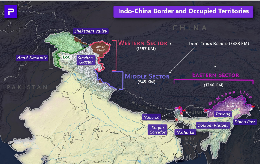
- India considers the LAC to be 3,488 km long, while the Chinese consider it to be only around 2,000 km.
- LAC is divided into three sectors:
- Eastern sector (spans Arunachal Pradesh & Sikkim): Boundary dispute over the MacMahon Line.
- Middle sector (Uttarakhand & Himachal Pradesh): It is the only one where India and China have exchanged maps on which they broadly agree.
- Western sector (in Ladakh): Boundary dispute pertains to the Johnson Line.
For details on LAC, visit >PMFIAS-IG-01-India |


