
Fluvial Erosional Landforms: Meander, Oxbow Lake, Peneplain
Subscribe to Never Miss an Important Update! Assured Discounts on New Products!
Must Join PMF IAS Telegram Channel & PMF IAS History Telegram Channel
Last updated on April 23, 2024 9:43 AM
- The landforms created as a result of degradational action (erosion and transportation) or aggradational work (deposition) of running water are called fluvial landforms.
Fluvial Erosional Landforms
- Fluvial Erosional Landforms are landforms created by the erosional activity of rivers.
- Various aspects of fluvial erosive action include:
- Hydration: the force of running water wearing down rocks.
- Corrosion: chemical action that leads to weathering.
- Attrition: river load particles striking, colliding against each other and breaking down in the process.
- Corrasion or abrasion: solid river load striking against rocks and wearing them down.
- Downcutting (vertical erosion): the erosion of the base of a stream (downcutting leads to valley deepening).
- Lateral erosion: the erosion of the walls of a stream (leads to valley widening).
- Headward erosion: erosion at the origin of a stream channel, which causes the origin to move back away from the direction of the stream flow, and so causes the stream channel to lengthen.
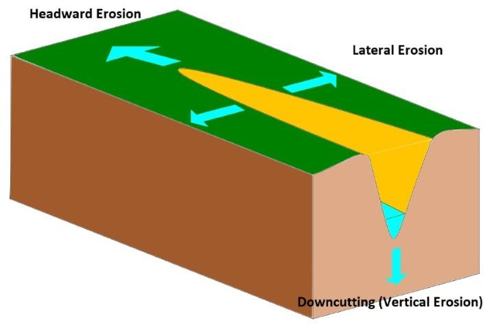
Vertical, Lateral and Headward Erosion (Kayau, from Wikimedia Commons)
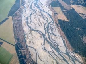
- Braiding: the main water channel splitting into multiple, narrower channel. A braided river, or braided channel, consists of a network of river channels separated by small, and often temporary, islands called braid bars. Braided streams occur in rivers with low slope and/or large sediment load.
River Valley Formation
- The extended depression on the ground through which a stream flows is called a river valley.
- At different stages of the erosional cycle, the valley acquires different profiles.
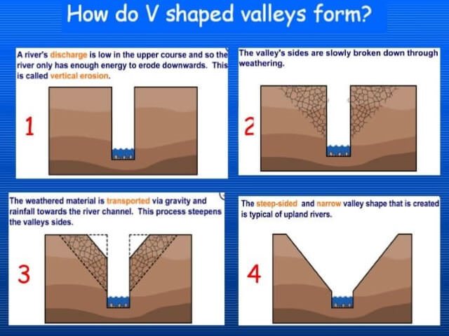
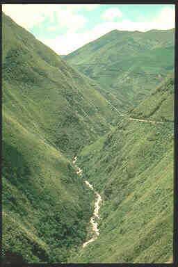
- At a young stage, the valley is deep, narrow with steep wall-like sides and a convex slope.
- The erosional action here is characterized by predominantly vertical downcutting nature.
- The profile of valley here is typically ‘V’ shaped.
- A deep and narrow ‘V’ shaped valley is also referred to as gorge and may result due to downcutting erosion or because of the recession of a waterfall (the position of the waterfall receding due to erosive action).
- Most Himalayan rivers pass through deep gorges (at times more than 500 metres deep) before they descend to the plains.
- An extended form of the gorge is called a canyon. The Grand Canyon of the Colorado River in Arizona (USA) runs for 483 km and has a depth of 2.88 km.
- A tributary valley lies above the main valley and is separated from it by a steep slope down which the stream may flow as a waterfall or a series of rapids.
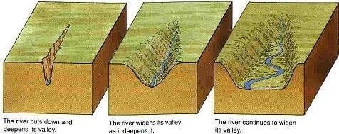
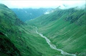
- As the cycle attains maturity, the lateral erosion (erosion of the walls of a stream) becomes prominent and the valley floor flattens out (attains a ‘V’ to ‘U’ shape).
- The valley profile now becomes typically ‘U’ shaped with a broad base and a concave slope.
River course
Youth
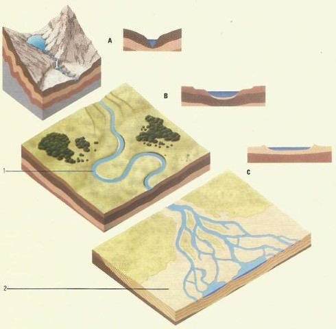
- Young rivers (A) close to their source tend to be fast-flowing, high-energy environments with rapid headward erosion, despite the hardness of the rock over which they may flow.
- Steep-sided “V-shaped’ valleys, waterfalls, and rapids are characteristic features.
- E.g. Rivers flowing in the Himalayas.
Maturity
- Mature rivers (B) are lower-energy systems.
- Erosion takes place on the outside of bends, creating looping meanders in the soft alluvium of the river plain.
- Deposition occurs on the inside of bends and on the river bed.
- E.g. Rivers flowing in the Indo-Gangetic-Brahmaputra plain.
Old Age
- At a river’s mouth (C), sediment is deposited as the velocity of the river slows.
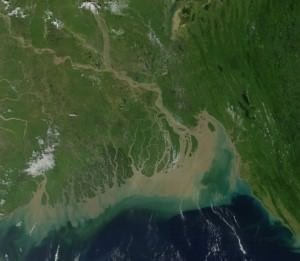
- As the river becomes shallower more deposition occurs, forming temporary islands (Majuli, a river island in the Brahmaputra River, Assam is currently the world’s largest river island) and braiding (e.g. braided channels of Brahmaputra river flood plain in Assam) the main channel into multiple, narrower channels.
- As the sediment is laid down, the actual mouth of the river moves away from the source into the sea or lake, forming a delta.
- E.g. Ganga-Brahmaputra delta.
Waterfalls
- A waterfall is simply the fall of an enormous volume of water from a great height.
- They are mostly seen in the youth stage of the river.
- Relative resistance of rocks, the relative difference in topographic reliefs, fall in the sea level and related rejuvenation, earth movements etc. are responsible for the formation of waterfalls.
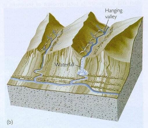
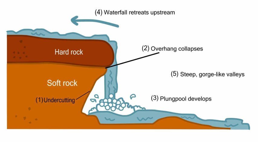
- Kunchikal Falls (it is a cascade falls ― falls with many steps) formed by Varahi river in Shimoga district, Karnataka is the highest waterfall in India (455 m).
- Nohkalikai Falls (340 m) is the tallest plunge waterfall in India. The waterfall is located near Cherrapunji.
- Jog or Gersoppa falls (253 m) on Sharavati river (a tributary of Cauvery), Karnataka is the second-highest plunge waterfall in India.
- Angel Falls in Venezuela is the world’s highest waterfall, with a height of 979 metres and a plunge of 807 metres.
- Tugela Falls (948 m) in the Drakensberg mountains, South Africa is the world’s second highest waterfall.
Potholes
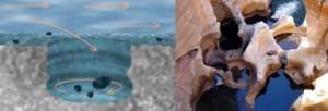
- The small cylindrical depressions in the rocky beds of the river valleys are called potholes.
- Potholing or pothole-drilling is the mechanism through which the fragments of rocks when caught in the water eddies or swirling water start dancing circularly and grind and drill the rock beds.
- They thus form small holes which are gradually enlarged by the repetition of the said mechanism.
Terraces
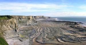
- Stepped benches along the river course in a flood plain are called terraces.
- Terraces represent the level of former valley floors and remnants of former (older) floodplains.
Gulleys/Rills
- Gulley is a water-worn channel, which is particularly common in semi-arid areas.
- It is formed when water from overland-flows down a slope, especially following heavy rainfall, is concentrated into rills, which merge and enlarge into a gulley.
- The ravines of Chambal Valley in Central India and the Chos of Hoshiarpur in Punjab are examples of gulleys.
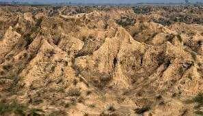
Ravines of Chambal Valley in Madhya Pradesh
Meanders
- A meander is defined as a pronounced curve or loop in the course of a river channel.
- The outer bend of the loop in a meander is characterized by intensive erosion and vertical cliffs and is called the cliff-slope side. This side has a concave slope.
- The inner side of the loop is characterized by deposition, a gentle convex slope, and is called the slip-off side.
- The meanders may be wavy, horse-shoe type or oxbow type.
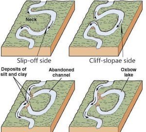
Oxbow Lake
- Sometimes, because of intensive erosion action, the outer curve of a meander gets accentuated to such an extent that the inner ends of the loop come close enough to get disconnected from the main channel and exist as independent water bodies called as oxbow lakes.
- These water bodies are converted into swamps in due course of time.
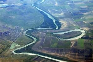
- In the Indo-Gangetic plains, southwards shifting of Ganga has left many oxbow lakes to the north of the present course of the Ganga.
Peneplane (Or peneplain)
- This refers to an undulating featureless plain punctuated with low-lying residual hills of resistant rocks. It is considered to be an end product of an erosional cycle.
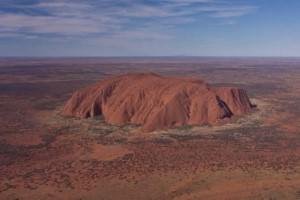
Uluru or Ayers Rock in central Australia standing on a peneplane
- Fluvial erosion, in the course of geologic time, reduces the land almost to base level (sea level), leaving so little gradient that essentially no more erosion could occur.
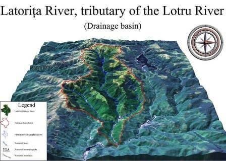
Drainage Basin
- Other terms that are used to describe drainage basins are catchment, catchment area, catchment basin, drainage area, river basin, and water basin.
- The drainage basin includes both the streams and rivers and the land surface.
- The drainage basin acts as a funnel by collecting all the water within the area covered by the basin and channelling it to a single point.
- In closed (endorheic) drainage basins the water converges to a single point inside the basin, known as a sink, which may be a permanent lake (e.g. Lake Aral, also known Aral Sea, Dead Sea), dry lake (some desert lakes like Lake Chad, Africa), or a point where surface water is lost underground (sinkholes in Karst landforms).
Drainage Divide
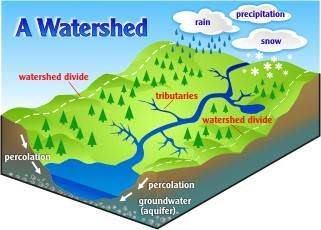
- Adjacent drainage basins are separated from one another by a drainage divide.
- Drainage divide is usually a ridge or a high platform.
- Drainage divide is conspicuous in case of youthful topography (Himalayas), and it is not well marked in plains and senile topography (old featureless landforms ― rolling plateaus of Peninsular region).
Difference between a River Basin and a Watershed
- Both river basins and watersheds are areas of land that drain to a particular water body, such as a lake, stream, river or estuary.
- In a river basin, all the water drains to a large river. The term watershed is used to describe a smaller area of land that drains to a smaller stream, lake or wetland.
- There are many smaller watersheds within a river basin.
- Example: watershed of Yamuna + watershed of Chambal + watershed of Gandak + …. = Drainage basin of Ganga.
Some important drainage basins across the world
|
Basin |
Continent |
Drains to |
Basin Area km2 |
|
Amazon River |
South America |
Atlantic Ocean |
6,144,727 |
| Hudson Bay | North America | Atlantic Ocean | 3,861,400 |
| Congo River | Africa | Atlantic Ocean | 3,730,474 |
| Caspian Sea | Asia/Europe | Endorheic basin | 3,626,000 |
| Nile River | Africa | Mediterranean Sea | 3,254,555 |
| Mississippi-Missouri River | North America | Gulf of Mexico | 3,202,230 |
| Lake Chad | Africa | Endorheic basin | 2,497,918 |
| Black Sea | multiple | Mediterranean Sea | 2,400,000 |
| Niger River | Africa | Atlantic Ocean | 2,261,763 |
| Yangtze River (Chang Jiang) | Asia | Pacific Ocean | 1,722,155 |
| Baltic Sea | Europe | Atlantic Ocean | 1,700,000 |
|
Ganges–Brahmaputra |
Asia |
Bay of Bengal |
1,621,000 |
|
Indus River |
Asia |
Arabian Sea |
1,081,733 |
Last updated on April 23, 2024 9:43 AM







In the braided channel subtopic, it is mentioned that it takes place on rivers with low slopes. But actually it occurs with rivers having steep slopes, kindly correct it
Sharavati is not a tributary of Cauvery. Sharavati is in uttara kannada. Cauvery is completely in the southern region of Karnataka. They flow in opposite directions. Please correct it.
Sharavati is a river which originates and flows entirely within the state of Karnataka in India. It is one of the few westward flowing rivers of India and a major part of the river basin lies in the Western Ghats.