NEW Preorder Ancient and Medieval Indian History ⚡️ Shipping from Aug 15th ★                      ★ NEW Prelims Cracker 2027 ⚡️ New Subjects from Sep 1st 📞 Call Now: 9211591415 ★                      ★ NEW GS Foundation 2027 ⚡️ Just Started ⬇️ Download Brochure 📞 Call Now: 9211591415 ★                      ★ PMF IAS Impact 🎯 53 Direct Hits in Prelims 2025 and 🎯 46 Direct Hits in Prelims 2026 ★

Importance of Chabahar Port for India — UPSC Prelims PYQ 2017

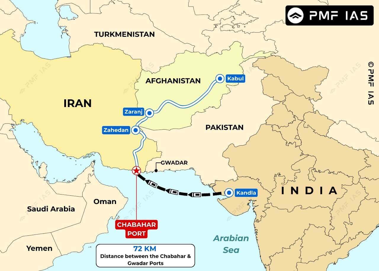
Map showing strategic locations and routes connecting Chabahar Port in Iran with Gwadar Port in Pakistan and key cities including Kabul, Zaranj, Zahedan, and Kandla. The map highlights a 72 km distance between Chabahar and Gwadar Ports, with routes marked by blue and black lines, and important ports and cities labeled in blue and red.

Additional Information

  • Chabahar is located at the mouth of the Gulf of Oman. It is situated in energy-rich Sistan-Balochistan province of southeastern Iran near the China-controlled Gwadar Port.
  • Chabahar is Iran’s only oceanic port and the first deepwater port that puts Iran on the global oceanic trade route map.
  • The port is part of the proposed International North-South Transport Corridor (INSTC), a multi-modal transportation project linking the Indian Ocean and Persian Gulf to the Caspian Sea via Iran, and onward to northern Europe via St Petersburg in Russia.
  • The Chabahar Project was signed in 2003, and the port is being developed in four Phases. There are two main ports in Chabahar – the Shahid Kalantari port and the Shahid Beheshti port. The Shahid Kalantari port was developed in the 1980s.
Answer: (c) India will not depend on Pakistan for access to Afghanistan and Central Asia; Difficulty Level: Easy
,