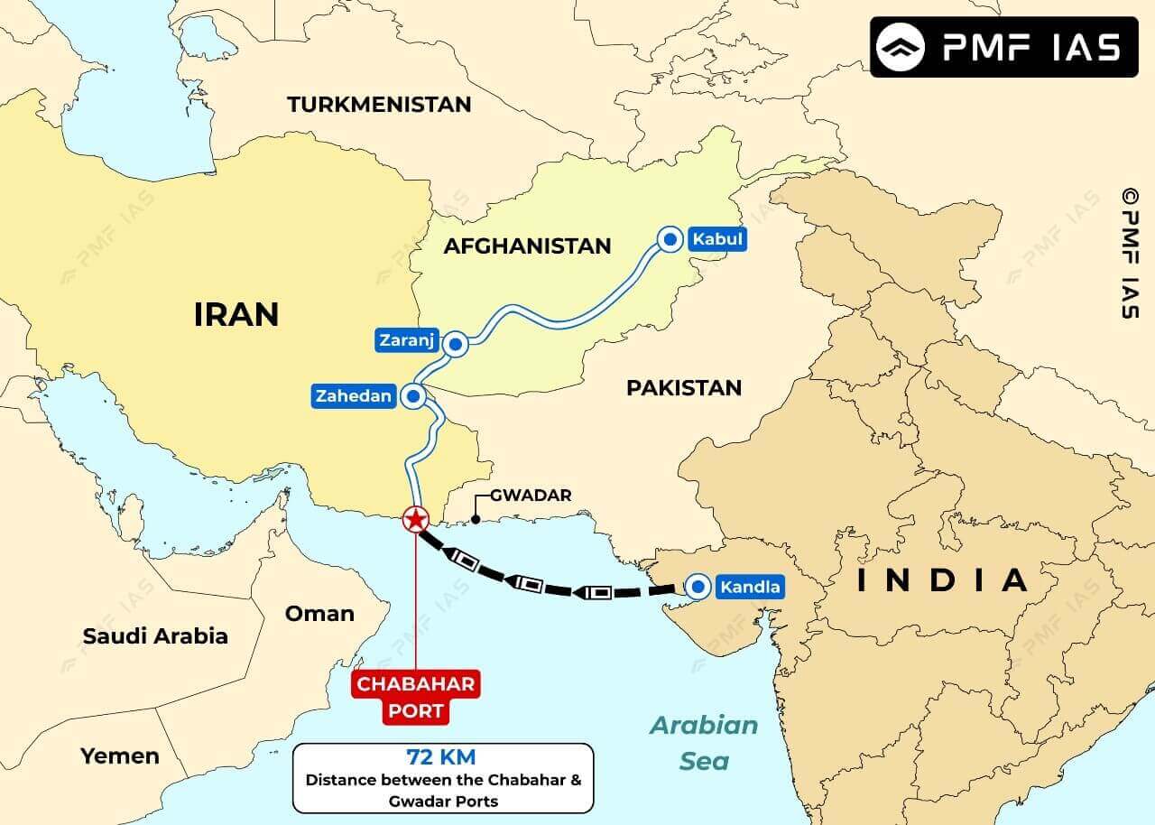
- Chabahar is located at the mouth of the Gulf of Oman. It is situated in energy-rich Sistan-Balochistan province of southeastern Iran near the China-controlled Gwadar Port.
- Chabahar is Iran’s only oceanic port and the first deepwater port that puts Iran on the global oceanic trade route map.
- The port is part of the proposed International North-South Transport Corridor (INSTC), a multi-modal transportation project linking the Indian Ocean and Persian Gulf to the Caspian Sea via Iran, and onward to northern Europe via St Petersburg in Russia.
- The Chabahar Project was signed in 2003, and the port is being developed in four Phases. There are two main ports in Chabahar – the Shahid Kalantari port and the Shahid Beheshti port. The Shahid Kalantari port was developed in the 1980s.
|